This trail provides access to Boreas Pass via the old Boreas Pass Wagon Road, which it connects to after crossing FDR 406.
Much of the trail above County Road 50 generally follows an old flume which diverted water from North Tarryall Creek and its tributaries to mining operations located in the upper Tarryall Drainage.
This trail is also a popular cross-country ski trail.
Details
Location:
Southwest of Denver
Setting:
Mountainous
Length:
16 mile roundtrip
Difficulty:
Intermediate
Time:
8 to 9 hours
Trailhead Elevation:
11000
Elevation Change:
1000
Season:
Summer, Fall and Winter
Useful Map(s):
USGS Quads: Como, Boreas Pass
Additional Details:
Water is not available at the trail heads or at Selkirk Campground.
Map + Directions
Basic Directions
The Gold Dust Trail begins off the Church Camp Road in the town of Como. The trailhead is approximately 5.5 miles from US Highway 285. There is a wide spot for parking in the road approximately .3 miles past the trailhead. There is also access along County Road 50, approximately 1.5 miles northwest of the Boreas Pass Road turnoff.
Below are the Free Visitor Guides for Monte Vista. More Visitor Guides are available in South Dakota. Click here to view them all!
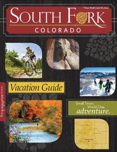
South Fork Southwestern Colorado
South Fork
Southwestern ColoradoAre you looking for a naturalist paradise with affordability? Then look no further South Fork is your destination. A world class golf course, gold medal fishing in the Rio Grande, and thousands of acres of National Forest to hike, bike, ATV, ski and snowmobile through. Request this Free Visitor GuideRequested!You're all set! Request a few more Visitor Guides, or complete the form below to receive your guides by mail.
We offer a compact version of Go-Southdakota for mobile users, allowing you to access just the information you need on the road. Of course, you can still use the full version of Go-Southdakota on your mobile device just as you can on your desktop.