From Road 4612, this trail climbs east to Bluff Lake. From there it climbs to a sub alpine landscape, ending at the junction of Clear Lost Trail No. 76 and Packwood Lake Trail No. 78 near the former site of Lost Lake Lookout. Features include Bluff Lake, Huntington Berry Patch, Coal Creek Mountain and Bear Grass Butte.
The Bluff Lake Trail was used by Native Americans to access a ridge system used by mountain goat hunters.
Below are the Free Visitor Guides for Grays Harbor. More Visitor Guides are available in South Dakota. Click here to view them all!
Grays Harbor Western
Grays Harbor
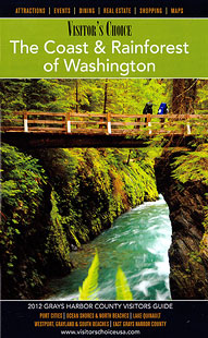
WesternSpend time for part of the day relaxing near the inspiring Pacific Ocean, then, if the mood strikes you, you could find yourself in a lush rain forest one hour later. Although water is a big part of Grays Harbor, there are still beautiful land-based places to visit and enjoy. Request this Free Visitor GuideRequested!You're all set! Complete the form below to receive your guides by mail.
Switch to Mobile Browser Mode
We offer a compact version of Go-Southdakota for mobile users, allowing you to access just the information you need on the road. Of course, you can still use the full version of Go-Southdakota on your mobile device just as you can on your desktop.