Ancient fossils still lie hidden in the bold and bronzen buttes of Badlands National Park, a protected wilderness penetrated by hiking and biking trails.
From Sutherlin, travel west on Highway 138 for 12 miles. Turn left at the Bullock Bridge, cross over the bridge and immediately turn right onto County Road 57 (Bullock Road). Travel.5 miles to Tyee. Campground is on the right.
Basic Info
Total Sites:
1
Head upstream, then kayak or canoe down to the pavilion for some food and relaxation.
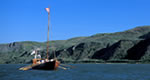
Fishing, especially for steelhead and salmon, is very popular in the Umpqua River.
For a more casual afternoon, a round of horseshoe on the grounds of the pavilion is also very fun.
We offer a compact version of Go-Southdakota for mobile users, allowing you to access just the information you need on the road. Of course, you can still use the full version of Go-Southdakota on your mobile device just as you can on your desktop.