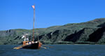
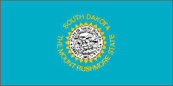
South Dakota Map

  • Places To Go
    Sioux Falls

    Sporting a pleasant city skyline of high-rise buildings set beside wandering river, Sioux Falls is both urban hub and gateway to lovely glacial lakes.

    Explore travel information for South Dakota cities, towns, parks, regions and more.

    Coverage for every state in the United States.

    Explore neighboring countries (and soon countries throughout the world).

  • Things To Do
    Things To Do

    South Dakota might be out of the way but its sights are noteworthy enough to draw a steady crowd, from Mount Rushmore's famous faces to caves, the Crazy Horse Memorial and the dramatic Badlands.

    Learn More

    Introduction to all the things to do in South Dakota.

    Searchable list of tour companies, guides and outfitters, rental companies and more.

    Full information on Tourist Attractions, Scenic Drives, Sightseeing Tours and easy vacation activities..

    Detailed information on active pursuits such as biking, hiking, golfing and much more.

  • Sleep + Eat
    Lodging and Hotels

    Use our easy Lodging Search to find exactly the type of accommodation you are looking for at the right price.

    Search Now

    Searchable listings of South Dakota hotels, motels, resorts, bed & breakfast, and more.

    Searchable listings of South Dakota RV parks and campgrounds.

  • Travel Planning

    Request Free Travel brochures from destinations throughout South Dakota.

    Transportation companies, airports and interactive maps for South Dakota.

    Travel and tourism books and maps for South Dakota.

    Basic facts about South Dakota, including a guide to every city and town in South Dakota.

    Searchable lists of South Dakota tourism offices and other helpful government agencies.

  • Photos + Videos
    Photo and Video Gallery

    Browse photos and videos from across the state, take a virtual tour, search for the imagery you want to see.

    View Now
  • Map It!

City and State Information for South Dakota

South Dakota Facts, Statistics, and State Symbols

State Flag

South Dakota

"Mount Rushmore State; Coyote State"

Motto
Under God the people rule
Capitol
Pierre
Name Origin
From the Sioux tribe, meaning “allies”
Statehood Date
Nov. 2, 1889 (40th)
Cities in South Dakota
 

NOTE: Not all cities are displayed. Please narrow your selection by using the search above.

Official Symbols

A state's official symbols represent the composition and culture of the land and people who live and have lived here. Below are the symbols of South Dakota along with the year they became official.

Flower American Pasqueflower (1903)
Grass Western Wheat Grass (1970)
Soil Houdek (1990)
Tree Black Hills Spruce (1947)
Bird Ring-Necked Pheasant (1943)
Insect Honeybee (1978)
Animal Coyote (1949)
Mineral Stone Rose Quartz (1966)
Gemstone Fairburn Agate (1966)
Colors Blue And Gold (In State Flag)
Song “Hail! South Dakota” (1943)
Fish Walleye (1982)
Musical Instrument Fiddle (1989)
Dessert Kuchen (2000)
Demographics
Population Density
9.9 people per square mile
Geography and Weather
Land Area
75,885 sq mi. (196,542 sq km)
Lowest Elevation
0 ft (0 m)
Average Elevation
2200 ft (670.56 m)
Highest Temperature Recorded
120°F (49°C) on July 5, 1936
Lowest Temperature Recorded
–58°F (–50°C) on February 17, 1936
South Dakota Rapid City Houseboating.org-Skyscraper-Space-Available

Email Page Link

Complete the form below to email this page to a friend or family member's email. You can send yourself an email as well. Your email and your recipient's email will NOT be shared with anyone. See our full Privacy Policy for details.
:
:
:


:
Copy Yourself on the Email Yes No
:
: