


Contact Info
Horseshoe Canyon Rd
San Simon, AZ
San Simon, AZ
Basics
- Length:
- 6-10 miles
- Difficulty:
- Difficult
- Trailhead Elevation:
- 5600 feet
- Elevation Range:
- 5600 feet to 9000 feet
- Elevation Change:
- 3400 feet
- Usage:
- Rarely used
Description
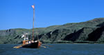
This canyon, laced with unique rock formations, colorful slopes and canyon walls, and tall trees, including maples and pine, is an excellent route for any hiker or horseback rider. Birds are especially plentiful.
Details
Length:
6-10 miles
Difficulty:
Difficult
Trailhead Elevation:
5600
Elevation Range:
5600 feet to 9000
Elevation Change:
3400
Usage:
Rarely used
Map + Directions
Basic Directions
- From Douglas, AZ
- Head north on US 80 for 41 miles until you reach Horseshoe Canyon Road (or FR 314).
- Go left or westward for 12 miles until you reach the end of the road.