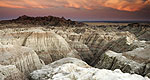
Ancient fossils still lie hidden in the bold and bronzen buttes of Badlands National Park, a protected wilderness penetrated by hiking and biking trails.
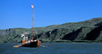
The 9,000 square mile Sand Lake Wetland Management District (WMD), located in north-central South Dakota, encompasses a rich diversity of wildlife habitat. The eight county district (Brown, Campbell, Edmunds, Faulk, McPherson, Potter, Spink, and Walworth Counties)is located within three distinct physiographic regions, the Missouri Coteau, the James River Basin, and the Lake Dakota Plain.The western portion of the WMD is in the Missouri Coteau and is composed of intermediate and short grass prairie. It is partly of glacial origin and partly a result of stream erosion by the tributaries of the Missouri River. It is comprised of a 40-50 miles band of rolling glacial hills and rugged river breaks located within 10 miles of the Missouri River.The James River Basin is a large glacially-eroded valley which is drained by the James River. The Dakota Lake Plain is a result of ancient lake deposits of silt and sand which formed under the old Lake Dakota. Mixed-tall grass prairie and agricultural lands comprise these two eastern regions.
We offer a compact version of Go-Southdakota for mobile users, allowing you to access just the information you need on the road. Of course, you can still use the full version of Go-Southdakota on your mobile device just as you can on your desktop.